|
|||||||||||
|
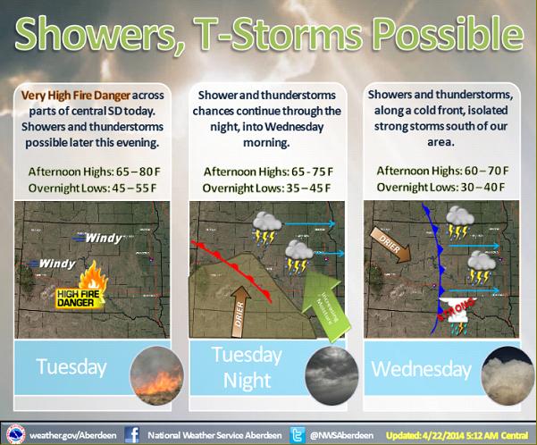
Dry conditions and gusty southeast winds will create very high fire danger across parts of central SD again today. A low pressure system will work its way out of the Rockies and into the northern plains tonight and Wednesday. Shower and thunderstorm chances begin tonight, however drier air being pulled into the system from the south may limit some precipitation chances. Additional showers and thunderstorms are then forecast along a cold front Wednesday afternoon. For right now, it appears any strong or severe storms will stay to the south of our area. |
||
|
|
||