|
|||||||||||
|
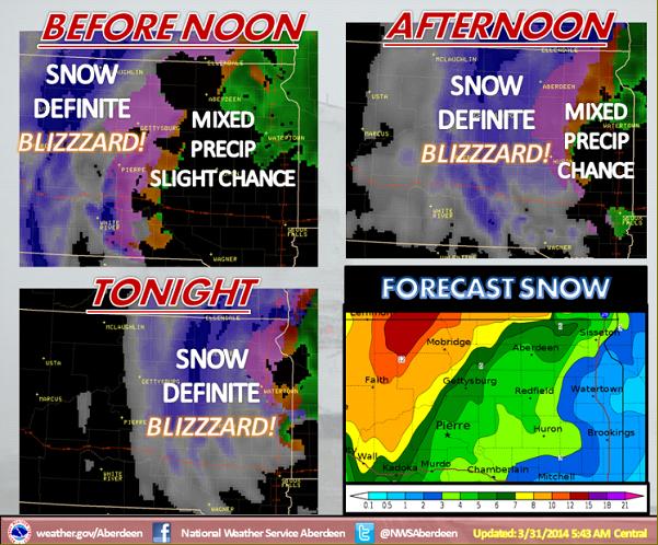
The onset of precipitation has slowed down a little more, and dry air may work north into eastern SD and west central MN initially this afternoon, however do not let this fool you. Precipitation will still spread from west to east across the area, changing from rain to snow, with sleet and freezing rain possible during this transition. Very little ice accumulation is expected, but it only takes a glaze on roadways to cause major travel issues! Once snow develops it will be heavy at times. Combined with strong north winds of 25 to 40 mph with higher gusts, white out conditions will occur! |
||
|
|
||