|
|||||||||||
|
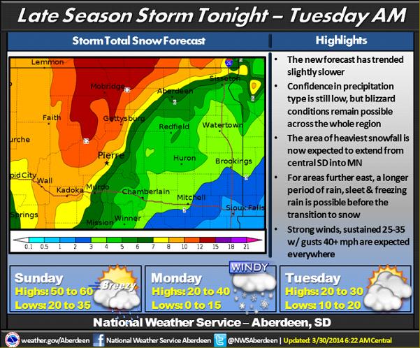
Forecast details are becoming more clear, however, some uncertainties still remain. The track of the system has slowed down. Due to this, areas further east will now remain under warmer air, and a prolonged period of rain before the transition to snow occurs. However, areas further west will transition to snow quickly, and significant accumulations are possible. Sleet and freezing rain are possible during the transition period. Wind speeds across the whole region will increase to 25 to 35 mph with gusts in excess of 40 mph. Blizzard conditions are possible by early Monday morning across the west and by later in the day Monday across the east. |
||
|
|
||