|
|||||||||||
|
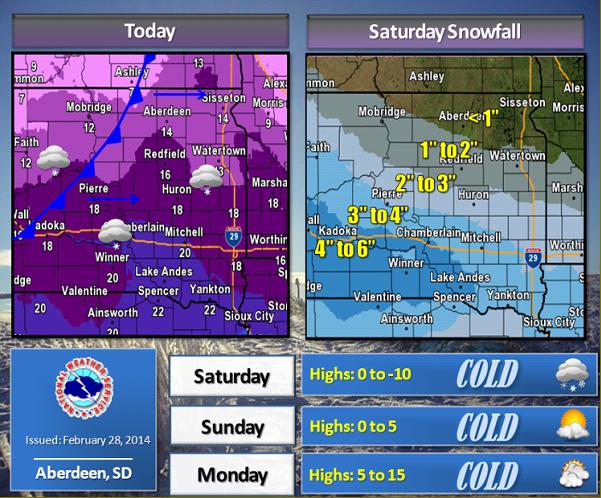
A front will move across the region today, with light snow possible for some areas. Very little if any accumulation is expected however. Northwest winds will increase with gusts to 25 or 35 mph possible this afternoon. Temperatures will also peak early today, then drop quickly behind the front. Overnight, lows will plummet into the single digits and teens below zero, with very cold wind chills expected. Another system will move into the region on Saturday, bringing additional snow chances. Up to an inch of accumulation is expected across northern SD and west central MN, however central SD could see snowfall amounts in the 3 to 5 inch range. Very cold air will remain in place through the weekend. |
||
|
|
||