|
|||||||||||
|
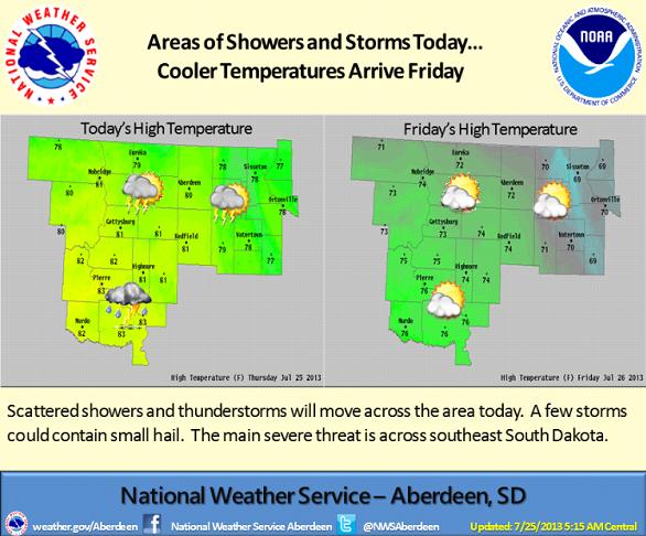
A shortwave trough will move southeast across the region today, along with a southward moving frontal boundary. This will bring scattered showers and thunderstorms to the area. The greatest threat for severe storms looks to be across southeast South Dakota. Cooler temperatures are in store for the weekend as Canadian high pressure sinks southward across the Dakotas. |
||
|
|
||