|
|||||||||||
|
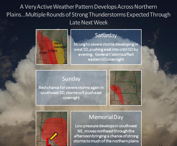
A very active weather pattern is forecast to develop over the weekend with multiple rounds of showers and thunderstorms expected. The most favorable location for severe weather tomorrow appears to be across western and southwest South Dakota, with the potential for a severe thunderstorm complex to translate east into central portions of the state during the late evening hours. The atmosphere will recharge Sunday allowing for more thunderstorms to develop across many of the same locations as Saturday. Several disturbances will aid in thunderstorm development through Memorial Day. Continue to monitor your local forecasts as we continue to pin down where the greatest threat for severe weather will develop on Memorial Day. |
||
|
|
||