|
|||||||||||
|
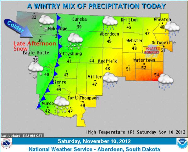
A low pressure system will bring a wintry mix to the region today. Warm air ahead of the system will allow precipitation to be mainly rain. However, there remains a slight chance of freezing rain across the northwest this morning and early afternoon. A cold front will then work its way from west to east across the region, turning rain to snow. Periods of mixed precipitation are possible along this front. Also, ahead of the front a weakly unstable airmass will be in place across eastern South Dakota and west central Minnesota. This will allow for the chance of an isolated thunderstorm to develop before precipitation turns to snow. Northwest winds will increase to 25 to 30 mph with gusts in excess of 40 mph behind the front. Falling snow combined with strong winds will reduce visibility. |
||
|
|
||