|
|||||||||||

|
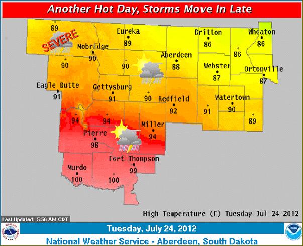
A stationary front located near the Nebraska-South Dakota border this morning will move northward as a warm front today, setting up near I-90 by late this afternoon. Very hot temperatures will occur along and south of this front. Thunderstorms are expected to move into central and north central South Dakota by early this evening, some of which could be severe with large hail and strong winds. Storms are expected to move east across the area overnight, with a continued threat for large hail. |
||
|
|
||