|
|||||||||||
|
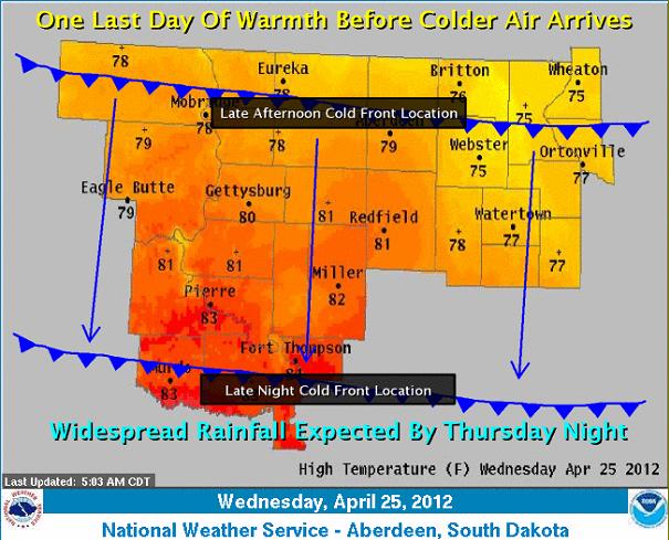
Warm air will hold across the region for much of the day before a strong cold front blasts through the region late this afternoon through tonight. The next chance for precipitation begins to develop Thursday afternoon across western South Dakota, before spreading into northeast South Dakota Thursday night and Friday. |
||
|
|
||